Figures
Preface || 1: The Setting
FIGURES
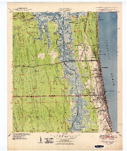
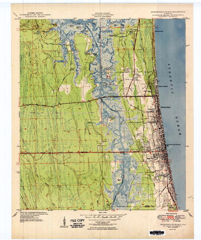
The Beaches 1949
Click on the map to enlarge it
Cover Images 1930s Post Card, 1954 Post Card
Figure 1-1 The Ocean
Figure 1-2 Calm Ocean
Figure 1-3 The Jacksonville Area
Figure 1-4 Bartolomé de Castro y Ferrer Grant
Figure 1-5 Andrew Deweese Grant
Figure 1-6 William Hart Grant
Figure 1-7 Mayport Ad
Figure 1-8 Jacksonville in 1864
Figure 1-9 Sculls' Dixie House
Figure 2-1 Sunrise
Figure 2-2 Murray Hall Hotel Ad
Figure 2-3 St. Paul's-By-The-Sea Episcopal Church
Figure 2-4 St. Paul's Catholic Church
Figure 2-5 1895 map of Duval County
Figure 2-6 U.S. Army on Pablo Beach
Figure 2-7 Army Marching on the Beach
Figure 2-8 Showing the Pavilion in the right background.
Figure 2-9 Colonel William Jennings Bryan
Figure 2-10 Henry M. Flagler
Figure 2-11 The Beach in 1900
Figure 2-12 Continental Hotel with Beach on the Right
Figure 2-13 Continental Hotel Rear View
Figure 2-14 Veranda of Continental Hotel
Figure 2-15 Buckman Atlantic Beach Ad
Figure 2-16 Buckman 1925 Map
Figure 2-17 W. H. Adams, Sr.
Figure 2-18 Atlantic Beach Hotel Brochure
Figure 2-19 Christopher-Bull House
Figure 2-20 Pablo Beach Elementary Students
Figure 2-21 Race Car, Pablo Beach, 1906
Figure 2-22 Cycle Racing, Atlantic Beach, 1915
Figure 2-23 Ocean View Hotel
Figure 2-24 Schematic Map of Downtown Pablo Beach
Figure 2-25 Ocean View Hotel Post Card
Figure 2-26 Pablo Beach Railroad Depot
Figure 2-27 Pablo Beach Showing Summer Cottages
Figure 2-28 Just South of Pablo's Downtown
Figure 2-29 Palmetto Avenue, Pablo Beach
Figure 2-30 Ocean Front, Pablo Beach
Figure 2-31 The Shore
Figure 2-32 Pablo Avenue, Looking East
Figure 2-33 First Street, Looking North
Figure 2-34 Mayport Docks
Figure 2-35 Railroad Station and Wharf, Mayport
Figure 2-36 1901 Mayport Baseball Team
Figure 2-37 Dickerson Avenue and 1st St. North
Figure 3-1 Pablo Beach in 1906. The Pavilion on the Right
Figure 3-2 Lifeguard Station, 1912
Figure 3-3 Shad's Pier, 1922
Figure 3-4 Pablo Avenue, June, 1917
Figure 3-5 Railroad Station, Perkins Bath House, Ocean View Hotel, Little Coney Island
Figure 3-6 Perkins House
Figure 3-7 Perkins Bath House and Rooms, 1930s
Figure 3-8 Atlantic Beach, 1924
Figure 3-9 St. Andrews AME Church, 2006
Figure 3-10 Orphan Asylum, 1924
Figure 3-11 African-American Neighborhood
Figure 3-12 Neptune, 1924
Figure 4-1 Casa Marina Hotel/Casa Marina Apartments
Figure 4-2 Atlantic Beach Hotel
Figure 4-3 Down the Roller Coaster, 1930/Looking South From The Roller Coaster
Figure 4-4 Lifeguard Station, Roller Coaster, and Penny Arcade , 1930s
Figure 4-5 Lifeguard Station, 1930
Figure 4-6 Jensen Building
Figure 4-7 Bellanca on the Beach
Figure 4-8 Fletcher's First Graduating Class
Figure 4-9 1935 Telephone Directory
Figure 4-10 Mineral City, 1928
Figure 4-11 Fletcher 1943 Graduation
Figure 4-12 Beaches White School Enrollments, 1940-44
Figure 4-13 Aerial Photo #1
Figure 4-14 Aerial Photo #2
Figure 4-15 Aerial Photo #3
Figure 4-16 Aerial Photo #4
Figure 4-17 Aerial Photo #5
Figure 4-18 Aerial Photo #6
Figure 4-19 Aerial Photo #7
Figure 5-1 Erosion Caused by Storms
Figure 5-2 Storm Damage, 1956
Figure 5-3 McCormick Bridge on Pablo
Creek/Intracoastal Waterway, 1972
Figure 5-4 Advertisement for McCormick
Apartments
Figure 5-5 McCormick Apartments at 9th
Avenue N.
Figure 5-6 Life Guard Station
Figure 5-7 Bathing Beauties, 1946
Figure 5-8 The Pier, Mid-1950s
Figure 5-9 Downtown Jacksonville Beach, mid-1950s
Figure 5-10 Mayport Shrimp Boats
Figure 5-11 1950, Looking South. The Building in the center is Fletcher
Junior-Senior High School
Figure 5-12 Looking South in Neptune Beach Down 3rd Street, ca. 1950
Figure 5-13 Neptune and Atlantic Beaches Intersect
Figure 5-14 Kelly's Fish Camp at the jetties
Figure 5-15 Houses Built Before 1970
Figure 5-16 Elementary School Patrol, Jacksonville Beach
Figure 5-17 Prudential Building on the south bank
Figure 5-18 Mayport and Seminole Road
Figure 5-19 Atlantic Beach
Figure 5-20 Neptune Beach
Figure 5-21 From Neptune Beach Through Jacksonville Beach Almost to Ponte
Vedra Beach
Figure 5-22 South Jacksonville Beach and Ponte Vedra Beach
Figure 5-23 Ponte Vedra Beach
Figure 5-24 Downtown Jacksonville Beach, 1960
Figure 5-25 Missing The Coaster Block and Pier, 1962
Figure 5-26 Mayport Pelicans
Figure 6-1 1964 Atlantic Beach Hotel After Hurricane Dora
Figure 6-2 Atlantic Beach Hotel (photo by Nancy Adams)
Figure 6-3 1964, Hurricane Dora. Le Chateau Restaurant
Figure 6-4 1964, Hurricane Dora. Le Chateau Restaurant
Figure 6-5 Seven Seas Drive-In Restaurant
Figure 6-7 Jacksonville Beach
Figure 6-8 Seaside homes in Jacksonville Beach
Figure 6-9 Ponte Vedra Inn & Club, 1964
Figure 6-10 City of Jacksonville Population, 1900-1990
Figure 6-11 The Boardwalk, 2004
Figure 6-12 Fuller Warren Bridge, Jacksonville